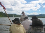
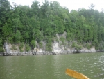
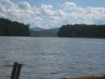
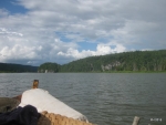
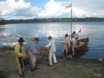
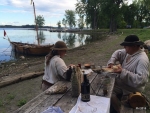
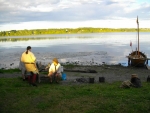
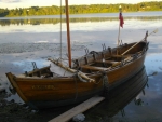
Also known as ‘The Big Row, 2015’
Photos were taken by Peggy Huckel, Bill Manthey, Kevin Richard-Morrow, and Kris Jarrett. Video was taken by Bill Manthey. The photographs and videos are copyright by the person who took them. Text is by myself, David Manthey.
Monday, 10 August 2015 – Rogers Island, New York
This Big Row is a repeat of the trip we did in 2005, except that we are only taking one boat and have a constant crew of seven. There are some minor logistical differences – instead of planning to camp at Whitehall, we will either camp before or after it as conditions dictate.
The weather forecast predicted southerly winds on Tuesday and Friday, and northwesterly winds on Wednesday and Thursday. Wind predictions are notoriously unreliable, and one should never put much stock in them. However, if the forecast had been all southerlies, I would have been tempted to try the trip with two boats. As it was not, I decided that it was better to be crowded in a single boat and make the trip than have lots of space in two boats and get stuck.
Our various rowers were to join us gradually, all meeting up tomorrow morning in time for the start. Kevin and I met at the Mabee Farm shortly after 1 p.m. I had the Bobbie G ready to go when Kevin arrived. I transferred my gear either to the boat or truck, we hooked up the trailer, and we were on our way.
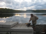
We stopped at the Rogers Island Visitors Center before we launched. It is closed on Mondays, and no one was there. The dock was as I had last seen it; a gentle plastic dock with a nice ramp.
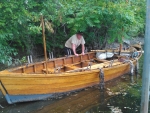
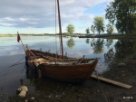
The launch is at the northern end of the island, and is officially for canoes and rowboats only. It is a very shallow ramp with a large pile of soil (or a very small island) just off shore. The area between this and the launch is barely sufficient to submerge the trailer enough to launch the boat. It was sufficient, though. We wrestled the boat off of the trailer, and climbed aboard.
Here was the first unexpected problem of the trip. Hithertofore, the Bobbie G has been a tight boat, with relatively little leaking. Two weeks ago, the larboard garboard strake began to leak due to a longitudinal crack in it. I had caulked this last Wednesday, and that was doing fine. Upon launching, the starboard garboard had developed a crack and the water was literally spurting in.
This was the worst leak we have ever had in one of our bateaux. In a matter of minutes, the bottom was covered in water, and a half hour after launching we had over an inch of water in the boat. Kevin and I discussed what we should do as we rowed the boat around the shoals at the north end of the island toward the dock.
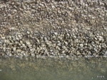
I used my smart phone to determine that there was a hardware store a short walk from the Fort Edward wall. We tied up at one of the ladders, and I went off to the hardware store. The small store I found looked like it was going to fail any day now; there was a “For Sale” sign in its window. It was open, and they did have caulk. Beggars can’t be choosers, and I ended up with some clear silicon “tub and shower” caulk.
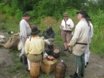
After returning to the Bobbie G, we rowed down to the dock. I contacted Reb and Bill who were en route and asked them to pick up some disposable gloves. Kevin and I started setting up camp. Reb and Bill arrived around 5 p.m.
Our first order of business after their arrival was caulking the boat. We placed a board on the shore, brought the boat along the shore and slid it up the board to careen it enough that the crack was out of the water. I used a multi-tool and a crochet hook to reef out the gunk in the crack on both the inside and outside of the boat. A file on the multi-tool was the closest I had to a scraper, so I couldn’t remove as much of the copper paint as I would have liked.
Lacking a caulk-gun, I ended up cutting open the tube of caulk and applying it by hand (with gloves). A messy process. The clear caulk looks more like mucilage than something I wanted on the side of the boat. The others helped by handing me tools and taking items as I was done with them.
The caulk had a three-hour minimum cure time, so from 5:30 to 8:30, Reb would rush down to the bateau when a boat would go by and make sure that the passing wake didn’t place the patched area in the water. Just before evening, we warped the boat back to the dock for the night.
We ate a simple dinner. Our other three rowers visited in the evening but did not stay the night. Everyone seems ready to go.
Tuesday, 11 August 2015 – Near Lock C-11, Whitehall
Today promises rain. When we got up at dawn it was only a light drizzle, but it would gradually get worse throughout the day.
We made a copious breakfast. The rowers who had not spent the night showed up with coffee and doughnuts, too.
The boat was less packed than it usually is at the morning of the row, as I hadn’t loaded anything in the previous evening due to the caulking job. We struck tents and gradually loaded the boat. It seems very crowded. We have what appears to be an excessive amount of food, including a large bag of ‘surplus.’ I tried to leave space for the rowers, but it was more cluttered than ideal.
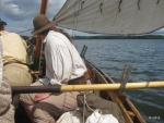
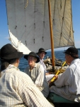
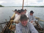
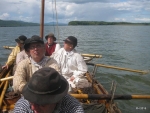
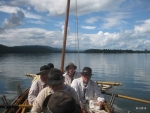
We got under way at 7:40. Not a bad start time for the first day. As we have a crew of 7, the intent is to have no more than 4 rowing at any one time and one steering. This should allow two people to rest (or at least not row) at any time.
The first three-quarters of a mile was south on the Hudson River. A light rain was falling. We rowed until lock C-7 was in view.
I radioed the lock, and received the promptest answer I have ever gotten when requesting lock passage. In short order, the lock opened for us and we rowed in. We told the lock master that we were proceeding north, but not to expect us to make more than two-and-half or three miles an hour.
When the lock opened, we resumed rowing. The rain had been light, but now there were bouts of heavier weather. There was no wind whatsoever, which, unsurprisingly, was contrary to the forecast.
Lock C-8 was only two miles away. It started raining harder, but we were all in good spirits and fresh, and we pulled reasonably rapid between the two locks. This lock was ready for us, and we went through promptly.
The six miles between lock C-8 and C-9 is quite straight. We passed a large dewatering facility used for processing the dredge spoils from the Hudson River PCB removal project. The workers paused briefly to wave to us. It continued to rain and was cold.
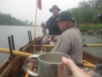
We had a morning rum call and passed around cookies. Dave sang some songs, and the rest of us attempted to join in on the choruses. We all swapped stories. We rowed.
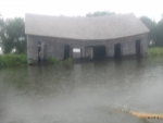
A very dilapidated house or barn is on the eastern bank. It is gradually rotting away, but is surprisingly intact considering that it has been rotting away for years. We joked about its ‘sunken living room’ and other amenities.
We stopped just below lock C-9 to use the facilities. Every time we have been at lock C-9, we note the wacky double-facilities. The restroom has two commodes side-by-each with no partition between them. In our modern age, this is far too intimate; we wonder what occurred that these were installed so.
After we were under way again, we ate a moving lunch. The rain was off-and-on at this point, and not much heavier than a drizzle. Lunch was our usual collection of sausage, cheese, bread, apples, and such. We had some miniature bell peppers which made a nice addition.
The stretch between lock C-9 and C-11 is comparatively bland. It is relatively straight with a number of small creeks feeding the canal and keeping up the water level. There are a few docks inviting one to stop at the nearby towns. There were a few other pleasure craft on the canal and a couple of barges that appeared to be related to the dredging project or the canal operation.
It is a little over nine miles between these locks, and we weren’t going as quickly as we had been in the morning. Some of this was due to fatigue, and some due to the repetitive scenery. We continued with good conversation and the occasional 18th century song.
Despite the repetition of the canal, some of this section is lovely. Short sharp rocky cliffs rise up on the southeastern bank. The northwestern bank is a berm with a train track.
The locks close at 6 p.m. this year. This is earlier than in years past. I knew that if we hadn’t locked through C-11 by 3:30, we wouldn’t make it to C-12 in time to lock through today. Prepared for this eventuality, I had scouted a few potential camping sites. We reached lock C-11 a little after 4 p.m. The rain had abated for the nonce.
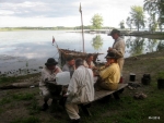
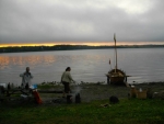
One possible site was at the bottom of the lock wall on the mowed area near the lock. The lock wall was tall and unforgiving, without a ladder. We continued on another 3/4 of a mile to a small landing that was at an end of a town field near a small woods. We pulled the Bobbie G into shore, and everyone disembarked, pleased to be done with rowing for the day.
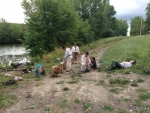
Our camping area had been used by countless people fishing and partying. Some of the refuse was quite nasty. A level, well-drained area was up a short hill. We talked with a local man who was walking his dog, and he told us that a fox with kits was living nearby.
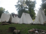
We unloaded the boat bucket-brigade style. We moved the tents and bedding up the hill and left the cooking and food items close to the water. Kevin got to work on dinner while the rest of us erected the tents. We rigged up clotheslines to try to dry our gear.
The brief lull in the weather didn’t last. The rain commenced again, and we hastened to get our clothes back under cover. Reb and Kevin took turns stirring the dinner pot in the rain, while the rest of us loitered in the our tents.
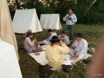
Kevin made a nice beef ragout. If we hadn’t been working all day, it would have been a bit heavy. It was lovely. Reb set out a dining room ‘table’, which looked just like a tarp on the ground. It was better than sitting on the wet grass or standing to eat, though.
We went to bed around sundown. Between fatigue, darkness, and rain, there wasn’t much incentive to stay up.
We went a total of 19.3 miles today.
Wednesday, 12 August 2015 -Benson Landing
Overnight we heard the fox barking. It sounded much like a little yippy dog. We also heard a few trains and a bit of rain.
We ate breakfast, struck camp, and gradually loaded the boat. We were a bit slow this morning, and didn’t get under way until around 8:30.
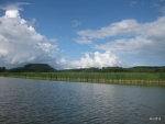
The canal here has numerous side channels. Small creeks join and leave, and the surrounding land is frequently swampy and flooded. Between the creeks are low-lying wooded areas with a few minor camps and houses.
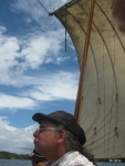
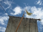
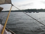
We pulled the six miles to Whitehall in about two and a half hours. The wind was light and a bit fluky, sometimes looking like it might help. We already had the sail rigged and ready to go. We hoisted it a few times to get a few puffs of wind, but as often as we did so, the wind veered about and took us mildly aback. I’m not sure it helped at all, but I don’t think it hurt, either.
When we reached Whitehall, we tied up at one of the several town docks. We were mostly stopping to use the necessary at the Skenesborough Museum. We took the opportunity to look at the remains of the Ticonderoga and to stretch our legs a bit.
We set off again, locked through C-12, and entered Lake Champlain. Here we are in the narrows of the lake. Historically, the upper lake was often considered with part of the Poultney River or Wood Creek, and not the lake at all.
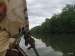
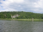
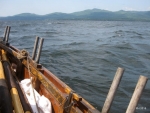
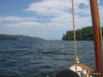
The narrows are a delight – winding, tree-lined, with sunken lands on either side. Areas that were high enough had the occasional house or remnants of old docks and other facilities. Osprey nests topped scraggly trees. The water was somewhat muddy.
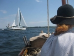
The course of the lake zigzags back and forth. We hoisted sail on some legs where it helped us a minor amount. We doused sail on others where it impeded us. A modern small cruising sailboat was also trying to sail down the lake. We shortened the distance when the wind was on the stern quarters, and they lengthened the distance when it was on the beam or ahead. Eventually they outpaced us, their taller fore-and-aft rig using more wind than we could.
The three miles or so to the entrance to South Bay passed very slowly, as the wind wasn’t helping much and we were intent on using it and resting rather than rowing constantly. At South Bay, the lake veers from a northwesterly course to a north-northeasterly course. The wind was no longer an aid, and we were back to rowing.
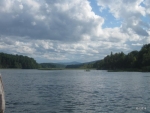
The lake here is a series of widening areas, each one slightly wider as one heads north. Between them, the land constricts. Along most areas there is sunken land to the east.
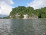
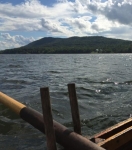
One of the narrowest constrictions is the Dresden Narrows where the lake is forced between two stout little hills forming short rocky walls at the water line. It seems more often than not the wind whips between these hills and the water at the Narrows is choppy and unpleasant. Today it wasn’t too bad; choppier than the rest of the lake, but nothing ferocious.
We weren’t going fast enough to make it to our originally planned destination of Chipman Point. I decided that we would stop at the boat launch at Benson. The last several miles from the Narrows to Benson passed very slowly. This is deceptively long, perhaps 4 or 4.5 miles, but with a low headwind it took us hours.
We passed the sailboat we had been playing tag with back in the southern end of the lake. They were anchored for the night. We rowed on and on. We also passed a canoe with an inverted triangular sail headed in the opposite direction.
As we arrived at Benson, we passed several cheerful houses on the lake front, worked our way around the point, and then pulled up to the town dock and boat launch. It was late afternoon, and we were content to be done.
As we were disembarking, one of the local residents who had watched us arrive came over and welcomed us to the town. Before long, several other residents also welcomed us, including a large dog named Moose (possibly a Weimaraner). A very warm reception – we were offered to camp on a woman’s grassy yard rather than on the dirt area of the town launch; we were brought some alcoholic cheer; we were offered a nice tie-up at a sheltered dock; we were offered the use of a flush toilet (though the boat launch had a portajohn we were pleased enough to use after last night).
We took our time unloading the boats, lugging our gear to the lawn, and setting up camp. David Mi. cooked a nice fry-up of ham and seasoned bread. Moose tried to make himself at home in various tents, offered to help us eat dinner, and generally made a cheerful, friendly nuisance of himself to our delight.
We turned in fairly early, all tuckered out. We covered around 20.4 miles today, as near as I can work out after the fact.
Thursday, 13 August 2015 – Monitor Bay Park, Crown Point
We spent a pleasant night on comfortable grass surrounded by friendly people. Three cheers for the town of Benson Landing.
We had a leisurely start. We cooked and ate breakfast at the water’s edge, struck camp, loaded the boat, and set out. A few of the local residents saw us off.
A light wind helped us along, which was a welcome change from last night. The three miles between Benson and Chipman Point passed quickly, but still took long enough that we were very grateful we hadn’t tried to make it yesterday afternoon.
The wind dropped away as we passed the Chipman Point Marina. Someday, perhaps, we’ll actually overnight there. They have a campground on a hill which looks pleasant enough. We greeted people on the docks as we rowed by.
Another mile and a bit brought us into view of Fort Ticonderoga with Mount Independence on our starboard side. We made the usual reenactor comments about how Mount Defiance was inaccessible, marveling how someone could think that who could see it from the water.
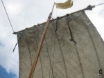
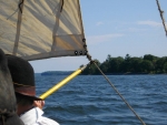
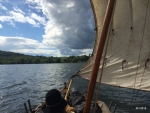
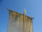
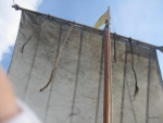
The wind veered about, and was often from the beam. We are using the lug sail, and I think we are finally getting the hang of using it for improved sailing when it isn’t just a stern wind.
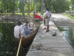
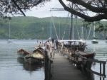
As we neared Ticonderoga Ferry we decided it was time for a nature break. We doused sail and proceeded under oars. The boat launch by the ferry has generous docks on either side of the ramp. The wind was still giving us some way, and I decided that pulling up to the northern outside dock was the best spot for us.
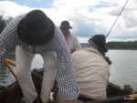
As we approached the dock, I asked the larboard rowers to pull in the oars. Unfortunately, Peggy was on the starboard side and thought she was included in the command and I wasn’t quick enough to stop her. She brought her oar in so that the loom extended on the larboard side of the boat, as she couldn’t toss it up due to the sailing lines. This was at just the wrong time, and the loom struck the edge of the dock and bounced against her shoulder and wrist. We didn’t realize it at the time, but Peggy fractured her wrist and got some ugly bruises, too.
We tied up and went off to use the necessary. The boat ramp is fairly busy, even on a Thursday. We talked with some of the boaters, a few of which were convinced they had seen us recently, though they were probably mistaking us for the Fort Ticonderoga bateau crew.
As soon as we set out again, we got the sail ready to hoist. Once we cleared the wind-shadow of the land, the sail went up. The wind veered around a bit, but was mostly from a useful direction. After a tiring day yesterday, we were glad for the reset.
The original plan had been to camp at Crown Point Historic Site, but because we had stopped early yesterday, I thought it would be too far a reach today. We called our contact there, thanked them for their offer of hospitality, and told them that we wouldn’t make it there this evening. The wind ended up being fresh enough that we contemplated if we could have made it, but ultimately prudence prevailed.
We were last on this section of the lake earlier this year in May. Then, we had been trying to go south and had a strong headwind that slowed us to a mile an hour while rowing our guts out, followed by sailing back to the north at high speed with a reef in the sail and another bateau under tow. This time we had a moderate southerly that was quite pleasant.
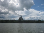
The Ticonderoga paper plant gradually appeared and took quite a long time to work past. It is a huge building, quite outsized compared to other structures along the lake.
The wind continued fresh from the southwest, and we delighted in sailing. Everything is easier when the wind cooperates. David Mi. led a few songs to help pass the time. We swapped stories. We ate.
I wasn’t completely certain where we should stop for the night. I was more experienced with some of the minor canoe camping spots than with spots appropriate for a bateau. Our boat may not be huge, but it is still too large to pull out of the water from a rocky landing.
We ended up near the middle of the lake as we approached the southern end of the town of Crown Point. On the New York shore there is a campground called Monitor Point. This looked inviting, and we decided it was better to take a chance on it than to keep going and end up struggling in to somewhere else.
We made a nearly ninety-degree left turn. Now, with the wind just forward of the larboard beam, we worked our way into Monitor Point. We sailed nearly into one of the berths along the park’s dock, rowing the last short distance.
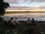
The campground is open to the public. We were allowed to camp right near the northern end of the beach. We rowed the boat close to the campsite, then formed a bucket brigade to pass gear from the boat to land. Peggy went off and found some ice for her wrist.
Here we were, in camp. It was only midafternoon, and we were comfortably ashore. We took our time. I eventually made dinner of stewed chicken and dried bread turned into dumplings.
At camp, Dave Mi. distributed some song books he had made to help us learn the words to various 18th century songs.
A pleasant day. We covered around 17.3 miles.
Friday, 14 August 2015 – LCMM, Vergennes
We had oyster hash for breakfast, struck camp, and loaded the boat. An early start today, as the morning is supposed to have favorable winds and we know enough to use them when we can. We rowed out into the lake before 8 a.m.
The wind promised to be fair, or even a little stronger than we might like today. So far, it was light and variable. Up went the sail, the oars paused. A moment later, down went the sail and the oars resumed. Three moments later, back up went the sail. A few minutes after that, we doused sail once again.
After covering the first few miles, the wind became more reliable. It came up a little gusty, but strong and useful. Reb and Judy took turns with the whisker boom.
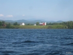
We passed the four decaying concrete pylons in the lake. One of them now sports an American flag. I don’t know what was originally mounted there; perhaps an excessively large navigation light.
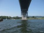
Only an hour and a half from departing our camp, we raised the Crown Point Bridge. Fifteen minutes later we were on the northern side of the bridge. As easy as it seemed this morning, it would have been a hard slog yesterday afternoon.
The wind direction was now mostly aligned with the lake. The breeze freshened as we increased the fetch from land. We had a bone in our teeth. Steering required some effort, but was under control. Bows reported that the whiskerboom was manageable.
The wind continued fresh, with occasional gusts. We covered the next four miles or so smartly. David Mi. led us in a few songs. The Vermont shore passed along at a distance of a half mile or so in spots, the farms looking neat and trim from this distance.
As we were passing Potash Point, one of the sheet lines parted. The sail immediately flapped wildly, and we rapidly doused it. The wind had been a bit gusty and the steering effortful, so I was actually pleased for the break.
The stern wind still pushed us along. We put out a few oars and assisted some. At this point the wind was from the starboard quarter, and just having a rower on the larboard side kept up both our way and our steerage.
We continued under light oars all the way to Scotch Bonnet Island. Even with only one or two oars working most of the time, this only took two hours.
Judy used a spare sheet line, prepared for just such purposes, and rerigged the broken sheet. We hoisted sail again and resumed our rapid progress.
We passed Basin Harbor and approached North Harbor. We tried to tack into North Harbor, but the land shadow blocked the wind and we ended up dousing sail. We rowed in to Lake Champlain Maritime Museum, arriving around 1 p.m.
A fast, relatively easy day. We covered around 19.3 miles.
After arriving, we took a break, ate food, and lugged gear up the hill to camp. Katie arrived in her car, and after unloading some items, helped get drivers back to their vehicles. By late afternoon all cars had been fetched from Rogers Island and all crew were back at LCMM. Our tents were set up, and we were settled for the weekend.
We went out to dinner at the Red Mill. Because today was mostly sailing, we weren’t as exhausted as we’ve been at the end of other trips.
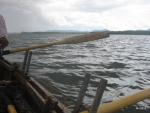
Rowing to keep the wind at the right angle
Saturday, 14 August 2015
An easy day. The morning was spent cleaning things, drying clothing, and resting. In the afternoon we participated in the mock battle. Some of the crew helped crew the Philadelphia II. The rest manned the Bobbie G, and we rowed around the harbor and fired the swivel gun. I’m sure we didn’t even cover two miles during the whole of the action.
Sunday, 14 August 2015 – Mabee Farm
Today we repeated yesterday’s battle. Afterwards, we sent Kevin with the boat trailer to the Fort Cassin boat launch. Bill, Reb, and myself rowed the boat from LCMM to the launch, which turned out to be around 3.2 miles.
We returned to LCMM, packed up camp, and eventually drove back to our homes.
