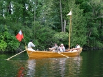
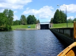
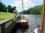
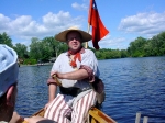
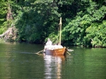
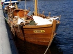
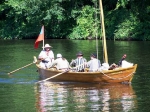
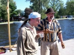
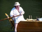
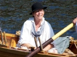
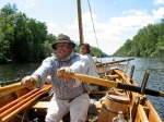
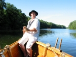
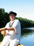
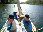
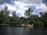
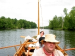
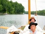
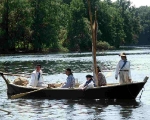
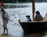
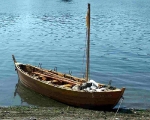
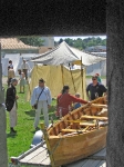
Also known as ‘The Big Row, 2006’
Preliminaries
This year the goal is to row from Rome, New York to Oswego, New York, following the north shore on Oneida Lake. I spent quite a lot of effort preparing this trip, from research on the ambush at Battle Island, to getting camping permits, to talking to reporters, to getting the boats in shape after floods and other events.
For more information on the boats and the organizations behind them, see elsewhere on this website.
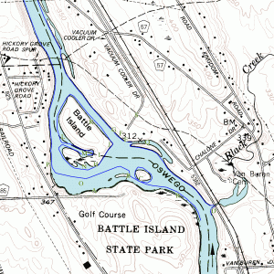 For more information on the historical account of Battle Island, see this PDF file.
A small map of the Battle Island area is shown to the right. The blue line is the maximal extent a bateau can travel based on river depth and weeds. The letters were useful for planning. C is the real Battle Island, B is Factory Island, H-I-J is faux-Battle Island, with H being our pre-battle landing spot. A is the canoe access location for the golf course.
Photographs
The photographs were taken by Shari Crawford, Kelly Harris, Bill Manthey, Jim Sparks, Dave Valentine, Ed Williams, and myself, David Manthey. All of them are copyrighted 2006 to one of us. Please inquire before using any of them. I have much larger versions of most of the photos. As always, click on a photo for a larger version.
To my ability, I’ve merged everyone’s photographs to form a continuous set in chronological order. A few of the pictures may be slightly out of sequence.
Monday, 7 August 2006 – Mabee Farm, Rotterdam Junction, NY to Bellamy Harbor Park, Rome, NY
After a huge amount of planning, some crew drop-outs, and lots of preparation, we begin this year’s Big Row. We had collected one crew member from the airport, had others join us as they drove into town, and others meet us en route. Most of us met at the Mabee Farm to begin the trip.
While we were attaching the boat trailers to their tow vehicles, we met a woman named Suzanne. She started talking with us, asking us what we were doing. We told her about the Big Row, and she commented that it sounded like we would have a great amount of fun. We concurred and told her that she was welcome to come along; she only needed “a strong back and a weak mind”. To my surprise, after asking several questions, Suzanne decided to accompany us. She asked the right questions, and I felt that she would not be a hindrance, even if she proved to not be a great help.
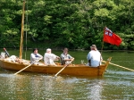
We towed the boats from Rotterdam Junction to Rome. Once in Rome we quickly launched both boats. The DeSager was captained by Kevin and crewed by Suzanne and Ed. I captained the Bobbie G with Reb and Bill as my crew. The boat ramp is around 1.4 miles from Bellamy Harbor Park, our destination for the evening. Dean drove to the park where we would be camping to help shuttle drivers back to their cars.
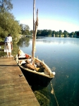
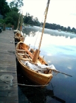
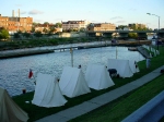
In the past, Bellamy Harbor Park has had a low dock that is small-boat friendly. Today the low dock was not present. An Erie Canal tour boat was tied up at the high dock, leaving just enough space for our two boats. We tied up, making fast to some broken cleats, and clambered ashore.
We had an equipment failure. One of the 5 gallon water “buffaloes” had sprung a leak and decanted its contents into the Bobbie G. This is unfortunate, as it is our drinking water. Fortuitously, I had enough reserve water that this is not an alarming problem.
Reb called Bob and asked him to bring clothes for Suzanne. Since Bob works at Fort Stanwix, this would not put him greatly out of his way. He assured us he would stop by in the morning.
We set up camp, had Dan procure dinner for us, then deposited Dan’s car at Godfrey Point, which is tomorrow evening’s intended camping spot.
While waiting and working, we spoke to a variety of pedestrians out for evening strolls or fishing. The questions ranged from fairly ignorant to smart curiosity.
Total distance for the day: 1.4 miles.
Tuesday, 8 August 2006 – Rome to Verona Beach, NY
Morning was typical of the first day of a Big Row. We dithered about, packing items and deciding what was needed and what would remain in vehicles. Dean cooked a nice breakfast of eggs with cheese, sausage, and coffee.
We moved the vehicles to an empty dirt lot and chained up the boat trailers. Bob showed up with a complete set of clothing for Suzanne, including eating utensils and a haversack. Dan showed up shortly after Bob and everyone was ready to go.
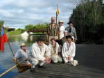
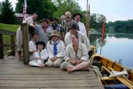
We had Bob take a group photo before he departed for work. Ed read a prayer for the boats and crew. By 8:15 or 8:30, we were on our way. The DeSager was crewed by Bill and Ed and captained by Kevin. I had Reb, Dean, Suzanne, and Dan in the Bobbie G. The morning was pleasant and the skies mostly clear. There was a slight headwind.
The first mile and a third recovered the water that we had passed over getting the boats into place. This is almost the entire length of the original high-water portage area. After this, we proceeded down the Erie Canal, occasionally glimpsing the remnants of Wood Creek as it crossed and recrossed the canal.
This area is somewhat dull – the canal is very straight with only the occasional bridge to relieve the monotony. Since it was the first day of rowing, no one seemed to mind. We talked as we rowed, catching up with old and new friends.
On the south side of the Canal we passed a dry dock. This dock looks somewhat abandoned and out of service. It is located at the junction of the modern Erie Canal and the historic canal from the 19th century.
Eight and a half miles into the row we reached Lock E-21. I think that everyone of our crew had previously been through a lock, so no one was especially amazed. I always enjoy the locks, and this time was no exception. I called ahead on the VHF radio. The response was sluggish since the lock master was mowing the lawn. We entered the lock chamber and dropped down 25 feet.
Lock E-22 is a mile and a half further west. We reached it in good order and still feeling fine. Another drop of 25 feet, and we were now at the level of the inlet to Oneida Lake. We tied up at the lower lock wall, and disembarked for a needed break and for lunch.
When we set off again, I took the oars in the Bobbie G, letting Dean steer. At some point we sent Dan over to the DeSager to even up the rowing power between boats. Aside from a rare power boat, we had the canal to ourselves.
Five miles after the second lock we approached Sylvan Beach. The Bobbie G was in the lead with myself rowing. Reb noticed a familiar figure on the eastern end of the terminal wall. It was Shari. She had been waiting for us for quite some time, and welcomed us with lemonade and scones.
The two boats tied up along the Sylvan Beach wall opposite some of the restaurants that cater to tourists and bikers. We clambered ashore, visited the necessary in a nearby restaurant, and started talking with people along the wall.
As we talked with people, a man from a sailboat came by to tell us not to attempt going out in the lake. He reported 20 knot westerlies and four foot waves. Reb and I walked to the edge of the lake and agreed that we didn’t want to attempt rowing into the headwind. Waves crashed over the breakwater, sending spray into the air.
We decided to wait for the wind to die down. I had anticipated this possibility, so I was not disappointed that we had been stopped in our travels. We found a shady picnic table near the underpass and opposite a tugboat and strange barge. Dean got out the necessary items to make dinner, and Shari and others helped him prepare the food. I paced back and forth along the wall, alternately talking with passers-by and talking with our crew.
Dinner was a tasty stew of beef, leaks, turnips, and some other vegetables. We had pie made by Katie for dessert. The pie was to celebrate Bill’s birthday.
After dinner, the crew gradually cleaned up and put things away. The wind had risen a bit faster in the later afternoon, and was now dying away. The waves were decidedly tamer. As dusk fell, Reb, Kevin, and I looked at the lake and decided that the six mile run to Godfrey Point was practicable. We packed up the boats and got ready. Shari borrowed a frock and cap and joined us.
Kevin and I secured lanterns in the rigging of each boat. These were primarily to serve as navigation lights so that other vessels would see us. The lanterns were not bright enough to illuminate our way. We set out, darkness falling. The waves were still a bit rough. A nearly full moon was just rising.
The breakwater at Sylvan Beach is around 3/4 of a mile long. As we proceeded along it, the waves were getting lumpier and less pleasant. A northwest wind was blowing. Unfortunately, the wind was coming directly from the point at which we needed to sail, and the waves were coming in at a significant angle to the wind. We were making decent time, but I doubt anyone was comfortable. I was filled with doubts.
As we neared the end of the breakwater, a large wave swept beneath both boats, rocking each of them in turn enough to extinguish the lanterns. This is quite a lot of rocking, as the lanterns are fully shielded. I consulted with Reb, and we decided that it would neither be enjoyable nor prudent to proceed at night.
I had the rowers in the Bobbie G row handsomely until the DeSager came with hailing distance. I told Kevin that we were going to turn around and retreat to Verona Beach. We both turned into the wind, then back to the beach. I kept astern of the DeSager so that I could make sure that everyone was doing well.
The ride back was easier than the trip out, but still lumpy and rough. Kevin and I showed electric lights often enough that we could be seen. A power boat coming in asked how we were doing; I responded that we were fine and thanked the boat’s crew for asking. We ran in to Verona Beach and the bright electric streetlamps, tying up both boats at the wall.
Once again we came ashore. I called a crew meeting and explained that given the wind, our best option would be to skip most of Oneida Lake. We had given it a good try, and prudence was better than exhaustion.
Reb took charge of setting up camp on a grassy area near the boats. Shari graciously drove some of us around, ultimately getting Dan home with his vehicle and getting the boat trailers and vehicles and Suzanne’s car to Verona Beach.
Camp was made, our blankets had been rolled out, and everything was ready for the night. I stayed up a bit to talk with some friendly locals who were fishing and to make sure our crew was doing well.
I should note that the camping spot I had hoped to use was the DEC boat launch at Godfrey Point. I can document bateaumen camping at the first point of land on the north shore of the lake, which I suspect is Godfrey Point. The boat launch is nothing special, having just a privy, a parking area, and a grassy sward. Our camping spot on Verona Beach is at least as nice.
Total distance for the day: 16.3 miles. Total distance for the trip: 17.7 miles.
Wednesday, 9 August 2006 – Verona Beach to Henley Park, Phoenix, NY
We woke fairly early this morning. Dean made breakfast much the same as yesterday with sausages, eggs, and cheese. Kevin, Suzanne, and I drove the boat trailers to a marina at the southeastern corner of the lake, then returned to camp in Suzanne’s car. We packed up the boats and departed. Verona Beach had been good to us.
The wind was light but still present this morning. We rowed out into the lake, heading further west than a direct route would suggest. The eastern end of the lake is very shoal, and it is necessary to head toward the center to keep clear of sand bars and weeds.
The sun was hot, and I could tell our rowers were tired from yesterday. Dan and Shari had departed, leaving us with a combined crew of seven. Suzanne was more effective than she expected, and was a great asset to our trip.
At the southeastern corner of the lake there are two obvious marinas. It had been quite a while since I had used the particular marina, and I was not confident that I recognized it from the water. We rowed to what appeared to be the easternmost marina. This looked wrong to me, and, once within its narrow channel, it was obviously not where we had left the trailers.
We rowed back into the lake and headed back to the northeast. From a distance, the area we approached looked like a trailer park. Beyond this was the marina that I remembered. We rowed in, and tied our boats up to the dock. I paid $8 to take out both boats.
We extracted both boats on to the trailers. For both of them, I unstepped the masts without fully unrigging the sailing gear. We crammed five people into Harvey’s van, put two people into Kevin’s truck, and headed west down Route 31. The land route is longer than the water route. We reached Brewerton, and I drove to a spot where I thought there was a boat launch. There was no launch at this site, and I had Reb go and inquire at a nearby restaurant. After some confusion, we drove a mile or so eastward to a large marina.
Kevin and I followed a long series of signs to the marina’s office. After finding the office, I paid a launch fee of $14 for the two boats. Their ramp is very narrow and mean looking.
I started to back up the Bobbie G. The ramp only had perhaps eight inches of total clearance between the two sides. Although I am competent with a boat trailer, this would have taken me many tries to get lined up. I turned things over to our expert, Reb. She did a fine job.
Reb backed in both boats, after which we secured them to the “courtesy dock”. I restepped the masts. We reloaded the few items we had taken out, parked the trucks, and set out. Suzanne had an alarming experience in the restroom before we departed, but no harm was done.
Back under way a little after 1 p.m., we now had a distinct head wind. We rowed under the three bridges in Brewerton. After we cleared the third bridge, we tied the two boats together and ate lunch. While eating, two rowers worked enough to keep forward way while I steered. This worked tolerably in that we covered a short distance while eating lunch rather than spending a lot of time standing still.
We are now in the Oneida River, which is lined with houses and restaurants. Many of the buildings show great expense, but not necessarily good taste. We waved and talked to people we saw along the shore and some of the boats that passed us.
After two miles of rowing we passed another marina which had a wide, beautiful boat launch. If we had known about this, we could have avoided the perilously narrow launch and saved Reb much stress.
Five miles from the marina we reached Lock E-23. We locked down the five or six feet. The original river now forms an oxbow around this area. There is a small dam on the far side of the oxbow, which prohibits the original navigation. After clearing the lock, we tied up to a small floating platform so that everyone could use the necessary.
In short order, we were under way again. My crew was tired, so I sent Reb to the DeSager and picked up the sculls and rowed. We proceeded thus down the Oneida River. Aside from the headwind, it was a glorious day. Suzanne got a chance to steer, which she clearly enjoyed.
As we travelled down the river, some of the passing boats had clearly heard of us. When arranging our camp site at the town of Phoenix, I had spoken to two women who are in charge of the Bridgehouse Brats. They had passed on our information to a local reporter, who had contacted me a few weeks back. Evidently, an article had appeared in a local paper telling people of our trip.
Here the row seemed quite long. I converted cookies and scones into distance, while the DeSager sometimes led and sometimes trailed the Bobbie G. We had the usual dilemma of whether to hug the shore to get as much shade as possible, or to take the shortest route down the river as we could.
Five miles beyond the lock we passed Pirates Cove Marina. This was the put-in spot for the Black Sheep, a bateau that is supposed to join us this evening. We speculated as to whether they would be waiting for us in Phoenix or arriving later. Pirates Cove has a few old abandoned wooden barges that form a sort of breakwater between the cove and the river.
Another mile brought as under Route 481 and alongside a small boat launch. A mile after that we reached Three Rivers Junction. To the west is the route to Buffalo. To the north is the route to Oswego. Naturally we turned north.
The headwinds continued as we proceeded down the Oswego River. A pontoon boat spoke us, relating that they had a newspaper article mentioning that we were coming. The pulled up to the DeSager and gave them a copy. This appears to be from the Syracuse Post-Standard, but I am not certain as the fragment doesn’t contain the masthead. It was amusing to learn that the article prominently stated that I would talk with people and answer questions.
On the west shore is the Syracuse canal maintenance facility. The tugboat Urger was moored there. She sounded her horn, and we tooted our tin horns back at her. One of the crew hassled us in a good natured manner. We professed that we were worried about the French.
Our two miles on the Oswego River passed quickly. Dean took over steering the Bobbie G, as the sun was a bit much for Suzanne. The DeSager continued to switch off rowers and steersman. Up ahead we could see the town of Phoenix and their lovely park. I rowed with vigor, eager to get there.
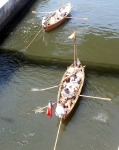
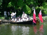
Henley Park is a lovely grassy park with a long wooden dock. The northern end of the dock has a lower section. We could see some power vessels moored along the southern end of the dock, and a low black bateaux at the northern low end. Between the vessels there was ample space for our two boats. I had anticipated this. What I had not anticipated was the hundred or hundred and fifty people waiting in the park to watch us row in and talk with us upon our arrival.
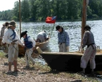
We slid up to the dock to be greeted by all manner of friendly faces. Some crew from the Black Sheep eagerly grabbed our mooring lines. Reb and I climbed onto the dock and secured the Bobbie G. Reb helped the DeSager dock. I was feeling very pumped and ready for more.
I immediately began to talk with the crowd. I told about the boats, the historic society, and our reenacting group. I gave a thumbnail history of Battle Island. I answered specific question on rigging, cargo capacity, crews, original river conditions and more. I met the ladies who I had talked with on the phone. I saw the mayor wander through in a very nice suit and talk with some of the crew. I answered more questions from many people. All of the question were good – no inane lack of understanding here.
While I talked, the Bridgehouse Brats helped haul our gear to the camping spot. This was of great help, though I scarcely observed it, being deep in conversation.
I eventually caught up with the crew of the Black Sheep. I think I had met all but their youngest crew before, but would not have been able to name them without assistance. Their captain is Dave V., stroke oar is Don, and their third rower is Jim. Their bows is a young girl who reminds me a lot of Reb (all in good ways). Her name is Rachael, though she is going by Nick when dressed in male clothing. Their youngest crew member is a lad named Sam. He was feeling a bit weatherly, I think due to a reaction to bug bites.
Eventually the friendly crowd thinned and I wandered up to our campsite. My tent had been pitched, and the crew had become friends with the crew of the Black Sheep. Dinner was cooking. This was a wonderful reception.
We had a very tasty dinner of lobscouse. This dish was a ham stew with the broth thickened with potato and a variety of vegetables in the mix. I don’t fully recall the details, except that it was divine. I continued to talk with passers-by as I ate.
The two ladies I had talked with both stopped by to make sure we had everything we needed. They got us copies of the Phoenix Register, a newspaper which contained an article about our trip.
Total distance for the day: 18 miles. Total distance for the trip: 35.7 miles.
Thursday, 10 August 2006 – Phoenix to Lock O-8, Oswego, NY
A somewhat slow morning, as my crew is still tired. As before, Dean prepared us an excellent breakfast of eggs and sausage. He also made some fried corn cakes, which were very tasty.
At some point, a group of us visited the Bridge House Museum. The Bridge House is a three story structure that was originally the control building for a draw bridge. The draw bridge was rare in that the two halves could be operated independently. A film called “Happy Birthday to Me” was made using the Phoenix draw bridge as a focal point for jumping cars.
The draw bridge is no longer present, and, today, the Bridge House is the home of the Bridge House Brats. The first floor has a variety of tools, a rest room, and other necessities. The upper two floors are a museum run by the Brats. The middle floor has some ‘older’ history, including two statues or mannequins. One is made up to represent Alexander Phoenix, after whom the town is named. I think the other is made up to be Schroeppel, one of the early settlers in the area. There is a variety of Indian paraphernalia, ranging from fairly recent ephemera to items of some historical significance. The upper floor has photos, charts, and artifacts relating to the Oswego Canal, the draw bridge, Mr. Henley (for whom the park is named), and other transportation items. There was also a small library for use of boaters in the park.
We were given a semi-guided tour by one of the Brats. The museum is quite small. It is better than some town museums I’ve visited, though hardly a place to spend a month.
When everyone was ready, we gathered briefly on the dock for a group photograph. Several of the townspeople had come by to see us off. One of the fellows taking pictures of us was a man around my age who looked fairly muscular. Reb asked him if he was interested in joining us for the day, saying that he looked like a rower. The man expressed interest. He asked a few questions, called his wife on his cell phone, gave his cell phone to a neighbor and climbed aboard the DeSager. His name is Jason, and he was a welcome addition to our power. At this point we had all climbed into the boats and were ready to cast off.
As soon as we had pushed off from the dock, I called Lock O-1 for passage. Down we went, and we are on our way.
The headwinds continued today, now from the north. The river is quite scenic in spots, with very few houses visible. There are some oxbows and coves that lend interest to the waterway. Although we were going with the current, the wind more than made up for it. I can tell my crew is tired.
I took a turn on the sculls for a while, letting Dean steer. I found I was not nearly so fresh as yesterday, and after a short while had Reb join in. We continued this way until the town of Fulton, some ten miles downstream from Phoenix.
The Black Sheep initially was a bit slower than the DeSager and the Bobbie G. As soon as our burst of energy from the morning was spent, the Black Sheep was the fastest of the boats.
Jason was obviously familiar with rowing. He told his fellow crew members in the DeSager about local points of interest. At some point, Ed asserted that we only had a short distance left to go before Fulton. I asked how he knew this, as the distance did not match what I expected. He replied that they had a guide.
As we approached Fulton, I called Lock O-2, still having Dean steer. The lock opened up smartly for us, and we descended 17 feet. Historically, the only portage on the Oswego was located here at the present site of the town. A half mile or so later, and we locked down O-3, dropping another 27 feet.
We pulled up for a lunch stop at the boat launch just below Fulton. The launch is a moderately steep cement ramp without any dock or other provisions. We landed the three boats on the somewhat rocky beach.
As always, Reb acts as our bows. Rachael is the bows for the Black Sheep, and she did a wonderful job. She’ll be truly excellent once she is a little older and heavier.
We carted lunch foods up to a picnic table in the shade. Lunch was the usual mix of sausage, cheese, bread, and fruit. We talked with a dozen people or so while eating.
Jason’s wife and children showed up during lunch. His kids found the outfit amusing. Jason had to depart; he returned the frock and cap and went off with his family. It was good to have him along.
After a long break, we returned to the boats and set out. A short distance later, we spied some young boys on the western shore racing down to the bank. In an instant they had donned PFDs and leapt into a metal canoe. They rowed rapidly toward us. There were three of them, all clearly related based on their red hair. The two at the ends of the canoe had regular paddles. The fellow in the middle wielded a stick, with which he did his best.
Struggling valiantly behind the canoe we could make out a paddle boat. It was far enough away that I couldn’t clearly see its occupants. It looked like two younger kids and possibly an older person. The paddle boat gave up after a short distance.
Since they were in a light canoe and we were in heavier boats, the lads quickly caught up to us. Reb asked them if they were Indians, to which they pointed out their hair color. We said that they could have been captured and raised as Indians. They assured us that they were not.
The boys paddled up to each of our boats in turn, speaking to each one. We told them about the event at Fort Ontario. They said that they had to go visit their grandmother and wouldn’t make it there.
After the canoe had been with us close for three-quarters of a mile, a small johnny boat with an outboard motor and two adults caught up with us. It was clearly the parents or chaperones of the boys telling them it was time to turn around and come home. They left us, waving cheerfully.
A short distance later we spotted a small weed harvester. This was a smaller version of the water-chestnut cropping machines that we saw on Lake Champlain last year. We huzzahed the harvester, as I expected that it had trimmed back the weeds for us at Battle Island.
Below a bend in the river, we could see Battle Island. I couldn’t see clear evidence of the weed harvester’s actions. I described the area to the others, looking at the old canal on the eastern shore, the concrete pier leading to Factory Island, and other points of interest. We stayed in the main channel as we didn’t want to go out of our way on account of fatigue and head winds.
It began to rain. This was accompanied by stronger north winds. The river heads north by northwest, so the wind was not quite directly in our teeth. I steered toward the eastern shore to get some cover from the trees. The rain came and went for the next few miles.
One of the crew desperately needed to use a restroom. I knew there was one at the town of Minetto just above Lock O-5. Minetto has a nice small-boat friendly dock. The DeSager came in “hot”, pulling up to the dock as fast as she could.
While we were taking a break, Dick arrived. He is a local fellow who had done a huge amount of work to help organize the Battle Island reenactment. He was surprised at our late arrival time, as he had not factored in us stopping for lunch. We talked with him briefly, then pressed him for the Bobbie G. I sent Reb over to the DeSager to give their crew some relief.
Down through Lock O-5. We traveled another three and a half miles. Now Dick served as guide to the Bobbie G, telling us a bit about the local area.
At some point we passed a number of houses. A largish fellow wearing just a pair of shorts and a cheap “pirate hat” hailed us from his dock. He quickly unlimbered a classic PVC potato gun, which he proceeded to fire repeatedly while calling questions and inanities to us. I only saw him fire one projectile, which traveled all of two yards. We were amused at his absurdity.
Lock O-6 and Lock O-7 couldn’t come quickly enough for us. Katie was waiting for us at Lock O-6, and followed our progress the short distance from there to our campsite just above Lock O-8.
The evening was glooming as we pulled up to the rough concrete wall at Lock O-8. The wall was unpleasant enough that thick fenders were a necessity. As Black Sheep only had thin fenders, we lent them three of our fenders. I called the main camp and asked for some people from Schuyler’s Company to come and help us.
Kevin and I were informed that there was an officers call for Battle Island at 9:30 that we absolutely had to get to. Instead of taking our crew out to a leisurely dinner, we ordered out for pizza.
The lock tender from Oswego-8 stopped by and gave us permission to use his rest room and shower. This was very much appreciated.
A variety of our friends showed up and started pitching tents. Although I thank them for helping us, I’ve never seen any tents so ill-pitched and misshapen. I suppose we can charitably attribute it to the tents being wet and therefore having shrunk.
Kevin and I departed for officers call before the pizza arrived. John, our field commander, drove us to Fort Ontario, and we stumbled in to the room where the meeting was to take place. A dozen other men joined us.
We went through the scenario for the next day, which had been moved forward an hour due to limitations on busses for getting soldiers from the Fort to Battle Island. I gave my account of what needed to get done, though I could not promise that we’d arrive in time. At long last everyone seemed to have a clear idea of what we were doing, and Kevin and I were brought back to camp.
I wolfed down cold pizza, saw off an away team to send Dick and Suzanne home, then went to bed.
Total distance for the day: 21 miles. Total distance for the trip: 56.7 miles.
Friday, 11 August 2006 – to Battle Island and to Fort Ontario, Oswego, NY
A nice easy morning. The north wind continues. Today, however, this will be of service to us.
Dean was up early making coffee and breakfast. He reported that the “potato pirate” stopped by with a box of donuts and an apology for acting like a buffoon. He amused us without endangering anyone; I have no gripe with him. His donuts were appreciated and consumed by many of the crew.
We made sure all the boats were ready for sailing, that everyone was fed and happy, and that the lock tender knew our plans. We left Reb’s cell phone with Katie so we could eventually call for a ride. We talked with all manner of passers-by, most of whom were fairly indifferent to us.
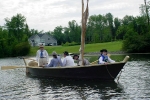
A little before 9 a.m., the bateaux were cast off from the mooring lines. I immediately radioed for Lock O-7, which opened for us after a ten minute wait. Under easy oars with a significant tail wind, we started on the day’s trip back to Battle Island.
We quickly locked through Lock O-7 and Lock O-6. Just above Lock O-6, all three boats set sail.
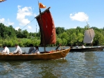
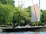
What a difference the direction makes! We slid along under easy sail, occasionally adding in some rowing to keep things moving when the wind became light.
My crew today is Reb, Dean, Harvey, and Andrew. The DeSager has Bill, Ed, Mary, and Bob serving under Kevin. The Black Sheep has the same crew as yesterday. We are delighted to have new rowers, and they, in turn, are delighted to not have to row much.
The distance between Lock O-6 and Lock O-5 went by quickly. As we approached the bottom of Lock O-5, the wind gusted a bit. Suddenly the DeSager leapt forward, leaving a definite V wake behind her and burbling water beneath her distinctly elevated bow.
We struck sail to enter the lock. At the upper end of Lock O-5 there was a bit of debris. Despite this, as soon as the gates opened, I had Reb hoist sail and we slid out under wind power. The other boats were more prudent and rowed out before setting sail.
This time we skipped landing at Minetto. As we sailed toward the first bend, some of the rowers spotted three vehicles pulling dories crossing the Minetto bridge. We know where our additional boats are headed, and expect them to be only a short ways behind us.
Bob played his fife in the DeSager. This was wonderful, really evoking an adventurous feeling as we sailed along.
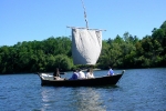
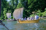
The sailing properties of the three boats became apparent as we traveled. The Black Sheep sailed fastest of the three boats when we had a light stern wind. I think that the reason is that she is the lightest boat. The Bobbie G sailed fastest of the boats when we had a strong stern wind. She has the most sail area. The DeSager sailed fastest when we had a wind off to one side. She has the best-made sail.
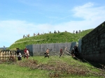
We swung around the backside of the island called Battle Island on the charts (henceforth faux-Battle Island). We had to drop sail on the far side of faux-Battle Island as it blanketed the wind. I could see that the weed harvester had cut a 30 foot wide swath to the canoe access point at the golf course. Continuing on, we found that the water was mostly clear to Factory Island, but weeded up at the northern end of the passage on the west side of Battle Island.
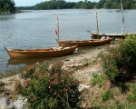
We scouted the landing spot on Battle Island and determined that it was a maximum of two boats wide. This was restricted compared to last time I was here. In the interim, storm waters had raised the river level and deposited several inches of thick mud over the normal gravelly bank. The mud will eventually wash away, but now it reduces available depth and makes landings less pleasant.
After scouting around, we all headed back to faux-Battle Island. We landed here for lunch and a rest break. As we were landing, the three dories hove into view, all loaded for bear with lots of troops. Each of the dories also landed on faux-Battle Island.
I discussed plans with the other captains. I directed the Major Eyre and the Bobbie G to land at the northern end of Battle Island. The Growler is to land on the eastern side of the island. The DeSager and General Arnold are to sweep either side of the island, and the Black Sheep is to pick off stragglers.
We set out, spotting some men at the canoe access point. Just as I was about to row over to them, a pontoon boat came into view and headed down the cleared swath toward these men. The pontoon boat picked up five or six indians and a soldier named Jeff. Jeff was delivered to the DeSager, which was not the most dexterous operation. The indians went off to Battle Island.
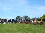
At the appointed signal, we started rowing northward, the Bobbie G in front followed closely by the Major Eyre. As soon as we were within musket shot range of Factory Island, some French troops opened fire. Not quite the original scenario, but close enough.
The rowers pulled smartly. A great many French and a few indians fired at us from the shore line. Most of these troops were distant enough that we were safe, but the quantity was high and the feeling almost unnerving (considering that we knew them to be our friends and firing blanks).
As we pulled the last few hundred yards to Battle Island, I could see a line of French milice wading across the ford at the southern end of the island. We landed, and Reb acted as bows, bringing both us and the Major Eyre in to shore.
Dean handed me a loaded musket, and all the armed troops clambered off the boats. I fired a shot or two across the channel at some of the French forces. We plunged into the woods. I advanced with Harvey and a few of Speakman’s Company. The French seemed to number in the twenties and held a clearing on the high ground at the southern end of the island.
Harvey and I kept pushing forward. The other soldiers dropped back or stopped following. We faced a large French contingent. I spotted Hank and Dan, as also Dick when we had joined us for part of the row yesterday. At one point Hank specifically had the entire milice target myself. It is nice to be loved.
We fell back and the French advanced. Speakman’s rallied and we advanced in a block, gradually pushing the French. The French fell back as per the original action; in truth they could have had the island with their position and force.
Reb had stayed with the boats and shouted for recall. As the French began filing off the island, we dropped back to the boats. Reb helped the Major Eyre off the mud flats, then we followed. The French were wading the ford in the distance. We could hear small arms fire on land and on the other side of the island. Later I would learn that the crew of the Growler had been bogged down by the indians and not advanced much beyond their initial landing.
The boats gradually regrouped as the action got further and further away from the shore. Kevin and the DeSager rowed to the canoe access point to drop off Jeff. This was complicated by the pontoon boat following them down the cut swath and greatly impeding the DeSager. Other boats don’t understand that we are functionally 20 to 25 feet in beam when we are rowing.
After the action on the water subsided, the three dories returned north. We could still hear sporadic activity in the distance. We thought it would be best to sail south three miles back to the Fulton boat launch and take the boats out there.
We set sail again and headed south.
When we were half a mile from Fulton, we saw frantic activity on the western bank. It was the young boys from yesterday that had followed us in their aluminum canoe. They scrambled down to the river bank, donned PFDs, and launched their boat. This time they were better prepared – all of them had paddles. In addition to the three lads, there was also a young girl. A paddle boat and a swimming dog set off just behind the canoe. The dog turned around after a short distance. The paddle boat gave up eventually as well.
Since we were now under sail, they could not gain on us. However, our take-out point was only half a mile from their home, so they caught up with us at the beach. We sent our away teams to go fetch boat trailers and vehicles. As this was happening, the boys’ parents arrived in their johnny boat. We offered to take the kids for a row in the Bobbie G. The parents agreed, then returned to their home to fetch two younger kids who had set out in the paddle boat but not reached us.
I had Reb as bows and Bill as stroke. Reb didn’t row, allowing the forward three thwarts to be used by the kids. I had them sit two to a thwart and had each pair work a single oar. They weren’t bad, through they kept wanting to paddle rather than to row.
We went out for ten minutes or so, sailing 500 feet and rowing the rest of the time. It turned out that the kids weren’t all brothers and sisters, but rather cousins. The parents and kids all thanked us when we landed. I’ve definitely had worse crew; with a bit more mass, these kids will be excellent rowers.
After some time the trailers for the various boats arrived. We extracted the boats and made our weary way back to the fort. We sent off an away team to go fetch Dean’s car from Rome.
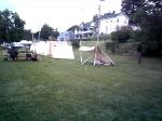
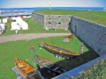
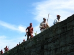
With much fatigue, we moved our camp from the lock to the fort. The boats were placed on display just outside of the main gate. We were given pride of place for our tents in easy sight of the boats. Dave from the Black Sheep set up a small awning using the oars for poles.
We ended up eating dinner at Coleman’s, which is a restaurant on the other side of the river from the fort. It was a pleasure to have a relaxed meal, even if I was so hungry that I bolted an entire steak. I am delighted with my crew.
A good, busy day.
Total distance for the day: around 12 miles. Total distance for the trip: 68.7 miles.
Saturday and Sunday, 12-13 August 2006 – Siege of Fort Ontario
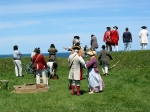
For the rest of the weekend, the boat crews and myself caught up on our sleeping and eating. We also talked with quite a few of the public. For the most part, I stayed near the boats and answered questions. It was pleasant to spectate the battles on Saturday and Sunday without having to participate.
On Sunday afternoon, we trailed the boats back to the Mabee Farm. A good trip, if not completely as planned.
